NOTE: Shop will be closed until February 14th, 2025 while I am in the field on Sable Island
I have just finished three Xmas craft shows in Halifax, all in November. One of the interesting things of doing this work, is the people who you meet. I met a lot of interesting people in November; they provided much inspiration.
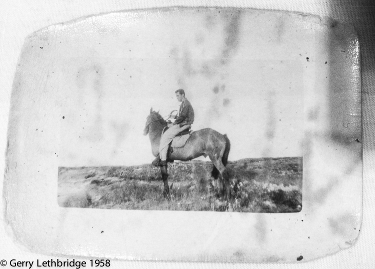
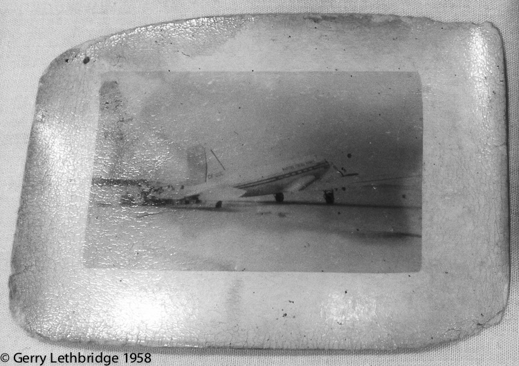
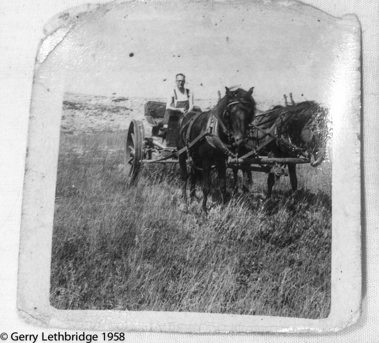
One of the people I met while at The Forum market was Gerry Lethbridge. He came to my booth and we began chatting about Sable Island. Gerry went to Sable Island in 1958 when he was in his late teens/early twenties while working for Department of Transport. He went out there as part of a small team studying the development of dunes. While we were chatting, Gerry pulled out these pocket sized photographs that he took while out there in 1958. He said that he carried these photographs with him in his wallet, so when he meets someone who might be interested he can show them.
When Gerry was on the island, the horses were being used as workhorses with people riding them and using them to pull carts. Thanks to Gerry for letting me post his photographs in this article.


I was out on Sable Island in 1958 at the same time as Gerry Lethbridge.
Gerry went out by plane with Transport Canada while I went out by ship with Canadian Coast Guard. The ship was the old Lady Laurier, a boat used mostly for setting warning buoys around the coast. This time, however, it was taking supplies to the maned Stations on the island. We we’re hit by hurricanes on the way out and the way back. The ship had to anchor anchor about a half-mile off-shore on the crescent side of the island because of the shallowness of the bottom. The first night we were there, after unloading the supplies, we we’re hit by another storm, which strung the 45 gallon oil barrels out ten miles along the beach, and shifted the sand so much that with very few steps off the beach you could be in over your head, whereas before you could practically walk out to the ship without doing so. Of course this is the reason Sable Island is known as “The Graveyard of the Atlantic” – ships would run around because the sandy bottom was unchartable, and then the sand would shift so quickly and with such force the ships would split in two. In 1958 the boilers of some such ships could still be seen in the surf. The establishment of lighthouse services helped save a lot of ships. There were two lighthouse stations in 1958 – East Light and Main Station. I think now there is just the one fully automatic radio beacon. Gerry was right – the people manning the stations used to break the wild horses and use them to pull rubber tired wagons (mostly – a few large horses were brought over from the mainland). Mechanized vehicles didn’t last very long because of the sand getting into and jamming the moving parts. There was a story going around that a ship carrying jeeps broke up on the sand bars and that they tried to use the jeeps but they soon gummed up. A ship wreck supposedly first brought the horses to the Island,
Thank you David for more interesting insight into life on Sable in the late 50s. I have been going out each year since Dc 1996 and can fully appreciate your words and description of the island. Two lighthouses remain on the island, the west and east light, but are no longer in use. Indeed the East Light is slowly being torn apart by the strong winds and shifting sand, following the pattern of those before it. One shipwreck re-appears at every low tide, the Skidby wreck not far from the main station on the west end of the island. Other shipwrecks appear but briefly, as sand is moved around after heavy storms, just as you describe. The horses are now fully protected and there are approximately 500 on the island. As I understand, there is no evidence to support the belief that a shipwreck brought horses to the island. Horses arrived on Sable Island from the mainland around the same time as when Acadians were evicted from Nova Scotia in the mid-1950s. There are currently ~500 on the island.